Projecting raster images with D3
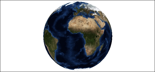
Until now, we have used svg to create maps. In this section, we will learn how to use D3 to project raster images in canvas elements. This will allow us to use JPG or PNG images to generate orthographic views of these images. A raster image reprojected using the Orthographic projection is shown in the following screenshot:

Rendering an image of Earth using the Orthographic projection (or any other projection) involves manipulating two projections. First, for each pixel in the original image, we compute its corresponding geographic coordinates using the image inverse projection. Then, we use the geographic coordinates of each pixel to render them using the Orthographic projection. Before beginning the implementation of these steps, we will discuss the inverse method of a projection.
Projections are functions that map geographic coordinates to points on the screen. The inverse projections do the reverse operation; they take coordinates on the two-dimensional...


