Search icon CANCEL
Subscription
0
Cart icon
Your Cart (0 item)
Close icon
You have no products in your basket yet
Save more on your purchases! discount-offer-chevron-icon
Savings automatically calculated. No voucher code required.
Arrow left icon
Explore Products
Best Sellers
New Releases
Books
Videos
Audiobooks
Learning Hub
Newsletter Hub
Free Learning
Arrow right icon
timer SALE ENDS IN
0 Days
:
00 Hours
:
00 Minutes
:
00 Seconds
Arrow up icon
GO TO TOP
Learning Responsive Data Visualization

You're reading from   Learning Responsive Data Visualization Create stunning data visualizations that look awesome on every device and screen resolutions

Arrow left icon
Product type Paperback
Published in Mar 2016
Publisher
ISBN-13 9781785883781
Length 258 pages
Edition 1st Edition
Languages
Tools
Arrow right icon
Authors (2):
Arrow left icon
Christoph Körner Christoph Körner
Author Profile Icon Christoph Körner
Christoph Körner
Erik Hanchett Erik Hanchett
Author Profile Icon Erik Hanchett
Erik Hanchett
Arrow right icon
View More author details
Toc

Table of Contents (11) Chapters Close

Preface 1. Getting Started with Responsive Design, Bootstrap, and D3.js FREE CHAPTER 2. Creating a Bar Chart Using D3.js and SVG 3. Loading, Filtering, and Grouping Data 4. Making the Chart Responsive Using Bootstrap and Media Queries 5. Building Responsive Interactions 6. Designing Transitions and Animations 7. Creating Maps and Cartographic Visualizations Using GeoJSON 8. Testing Responsive Visualizations 9. Solving Cross-Browser Issues Index

Overview of cartographic visualizations


The goal is to display cartographic data on an interactive and responsive visualization using D3.js similar to the following example:
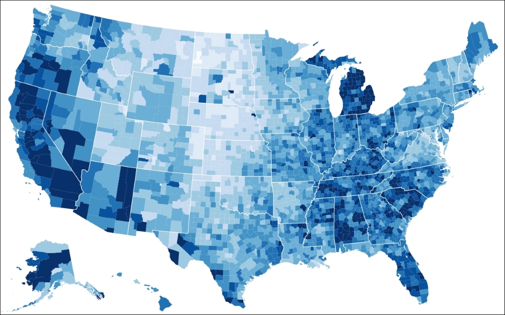
The Choropleth map of USA (source: http://bl.ocks.org/mbostock/4060606)

However, this is not a straightforward task such as drawing a simple bar chart. There are many things that need to be considered when building a cartographic visualization, and this section will introduce you to these different steps and techniques. Let's get started straightaway and look at all the different components from a bar chart and how they can be compared to a cartographic visualization. This will give us enough knowledge on how to tackle the problem.

A geographic coordinate system

When we draw a bar chart, we usually start by drawing a coordinate system—a Cartesian coordinate system to be precise—usually represented as axes. This coordinate system defines how we can find the desired coordinates to draw a bar; it shows us the x and y directions...

lock icon The rest of the chapter is locked
Register for a free Packt account to unlock a world of extra content!
A free Packt account unlocks extra newsletters, articles, discounted offers, and much more. Start advancing your knowledge today.
Unlock this book and the full library FREE for 7 days
Get unlimited access to 7000+ expert-authored eBooks and videos courses covering every tech area you can think of
Renews at $19.99/month. Cancel anytime
Banner background image