Unlocking heightmaps’ power
One of the most powerful options in the Landscape creation process is the possibility to generate a Landscape from a heightmap. As we’ve already seen, a heightmap is a grayscale texture that defines the height. A purely white-colored pixel means the maximum height value and pure black means the opposite. In the case of a Landscape, a heightmap defines the Level of height the Landscape will be raised to in a pixel.

Figure 9.33 – An example of how a heightmap works
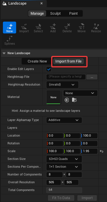
To generate a Landscape using a heightmap, we need to select the Import from File option in the Landscape mode’s New panel.

Figure 9.34 – Import from File tab in the Landscape mode’s New panel
Most of the options that we can find inside the Import from File tab are the same as we have already seen inside the Create New tab. Let’s look at the options dedicated to heightmap importing:
-
...


