Meshing and the environment
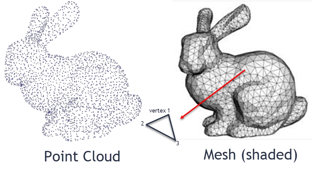
So, being able to identify features or corners of objects is really just the start of what we would like to know about the user's environment. What we really want to do is use those feature points to help us identify planes, surfaces, or known objects and their pose. ARCore identifies planes or surfaces automatically for us through a technique called meshing. We have already seen how meshing works numerous times in the advanced samples, when ARCore tracks surfaces. Now, before we get ahead of ourselves, let's picture what a point cloud and mesh look like in 3D, with the following diagram:

Point cloud and mesh in 3D
Note
If you pay attention to the diagram, you will see an inset figure showing a polygon and the ordered set of vertices that comprise it. Note how the order of points goes counterclockwise. Yes, the order in which we join points makes a difference to the way a surface is facing when a mesh is lit and shaded. When a scene is rendered we only see surfaces...


