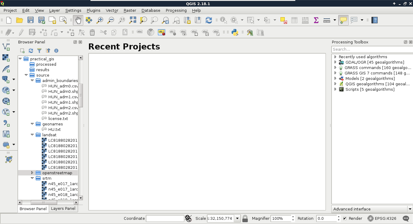
The first data type that we will use is raster data. It might be the most familiar to you, as it resembles traditional images. First of all, let's open QGIS. In the browser panel, we can immediately see our downloaded data if we navigate to our working directory. We can easily distinguish vector data from raster data by their icons. Raster layers have a dedicated icon of a 3x3 pixels image, while vector layers have an icon of a concave polygon:

Don't have a browser panel? You can toggle panels from the View menu's Panels option. If it is displayed, you can dock it anywhere by dragging it out from its current place and placing it in another part of the GUI.
We can drag and drop most of the data from the browser panel or, alternatively, use the Add Raster Layer button from the Add layer toolbar and browse the layer. The browser panel is more...


