Search icon CANCEL
Subscription
0
Cart icon
Your Cart (0 item)
Close icon
You have no products in your basket yet
Arrow left icon
Explore Products
Best Sellers
New Releases
Books
Videos
Audiobooks
Learning Hub
Conferences
Free Learning
Arrow right icon
Arrow up icon
GO TO TOP
Learn QGIS

You're reading from   Learn QGIS Your step-by-step guide to the fundamental of QGIS 3.4

Arrow left icon
Product type Paperback
Published in Nov 2018
Publisher Packt
ISBN-13 9781788997423
Length 272 pages
Edition 4th Edition
Languages
Tools
Arrow right icon
Authors (2):
Arrow left icon
Anita Graser Anita Graser
Author Profile Icon Anita Graser
Anita Graser
Andrew Cutts Andrew Cutts
Author Profile Icon Andrew Cutts
Andrew Cutts
Arrow right icon
View More author details
Toc

Running QGIS for the first time

In recent years, QGIS has become the most popular open source desktop GIS software. Some people are using it just to view and query data, while others are using it for much deeper analyses. Maybe you are an ecologist or a town planner needing to use GIS as part of your job. Maybe you have a background in proprietary GIS software and want to migrate some of your common workflows to open source. Or maybe you are a student that needs to use GIS for a project. Whatever your driving reason is for opening this book, welcome to an amazing community that is passionate about open source and GIS.

The following screenshot shows how QGIS 3.4 will look when it is first opened. In this case, there are no recent projects here and the interface is uncustomized:
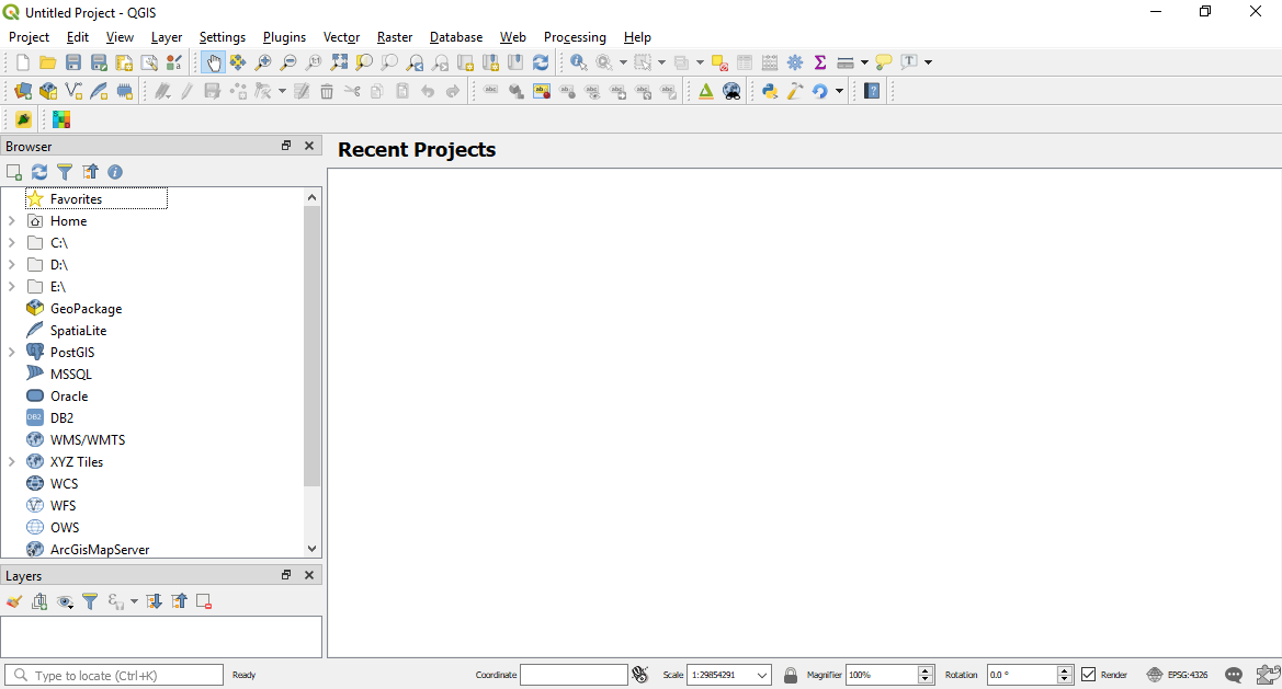
How QGIS appears once opened for the first time

On the first run, not all toolbars are enabled. You can enable all the default toolbars (meaning the ones not associated with any additional plugins) via Toolbars in the View menu. Set up the QGIS environment according to your personal preferences via the Toolbars option shown in the following screenshot:
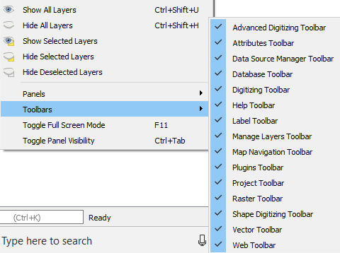
Setting the toolbars
Leave the default settings enabled for this book. We will guide you through the toolbars and panels in detail in later sections.

Plugins

Plugins are a unique feature of QGIS. In Chapter 6, Extending QGIS with Python, we will cover how to build your own. Plugins are available to be installed as you need them to enable further analysis. If what you want to do is not available within your current QGIS setup, search in the plugins as someone may have developed a tool to help you reach your solution. To access the Plugins, navigate to Plugins in the menu and then select Manage and Install Plugins:

Opening the Plugins menu

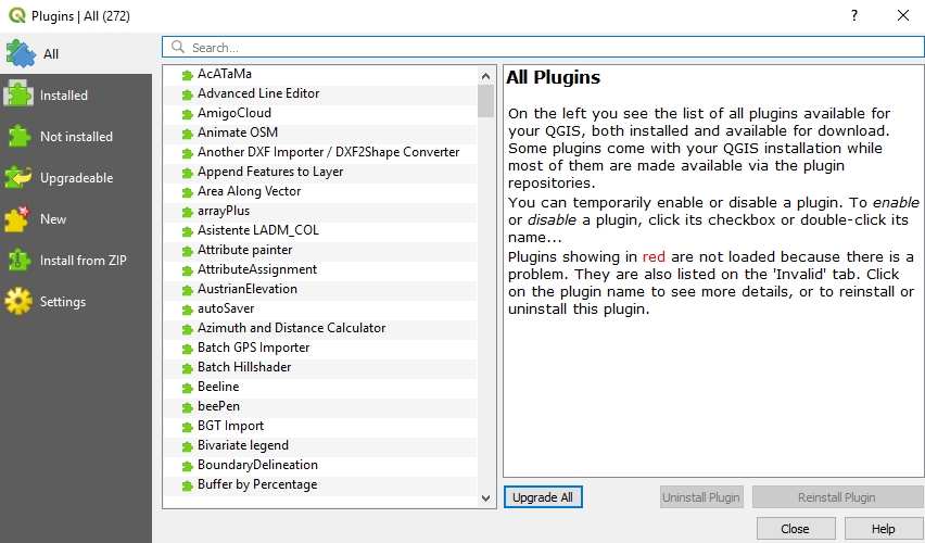
By clicking on the preceding option, the following window will be displayed:

List of plugins currently installed

The Plugins window will display the number of plugins installed in parentheses. In the preceding example, 272 are shown. You can search for plugins in the search box, install or upgrade individual plugins, or Upgrade All. Plugins are activated by ticking the check boxes beside their names. In QGIS 3.4, an icon will appear in the bottom-right corner of the information bar if there are any updates available for the your installed plugins.

For a list of all the available Plugins, including the latest and most popular, navigate to https://plugins.qgis.org/. This is an ever-growing list!
You have been reading a chapter from
Learn QGIS - Fourth Edition
Published in: Nov 2018
Publisher: Packt
ISBN-13: 9781788997423
Register for a free Packt account to unlock a world of extra content!
A free Packt account unlocks extra newsletters, articles, discounted offers, and much more. Start advancing your knowledge today.
Unlock this book and the full library FREE for 7 days
Get unlimited access to 7000+ expert-authored eBooks and videos courses covering every tech area you can think of
Renews at $19.99/month. Cancel anytime
Banner background image