About & Status
This area gives you information about runtime variables and how GeoServer is described to clients that connect to it.

Server Status
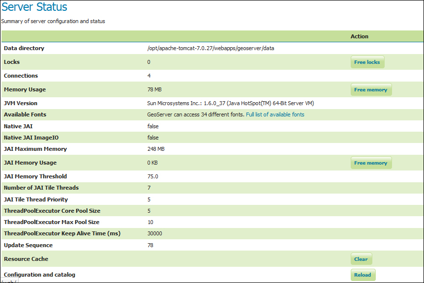
Server Status gives you a nice overview of the main configuration parameters and information about the current state of the GeoServer. The information is organized in a table view. Other than being informative, this view lets you perform some maintenance operations. We will describe the main items listed in the following screenshot:

Locks
Using Transactional Web Feature Service (WFS-T) a client may edit the configured feature types. To avoid data corruption, GeoServer locks the data on which a transaction is required until it ends. If the number shown is greater than one, then there are some transactions going on with your data. The Free Locks button lets you reset a hung editing session, removing any orphan processes to free locks that might have been abandoned.
Connections
This shows you the number of vector data store connections. Vector data...


