Search icon CANCEL
Subscription
0
Cart icon
Your Cart (0 item)
Close icon
You have no products in your basket yet
Arrow left icon
Explore Products
Best Sellers
New Releases
Books
Videos
Audiobooks
Learning Hub
Conferences
Free Learning
Arrow right icon
Arrow up icon
GO TO TOP
Hands-On Geospatial Analysis with R and QGIS

You're reading from   Hands-On Geospatial Analysis with R and QGIS A beginner's guide to manipulating, managing, and analyzing spatial data using R and QGIS 3.2.2

Arrow left icon
Product type Paperback
Published in Nov 2018
Publisher Packt
ISBN-13 9781788991674
Length 354 pages
Edition 1st Edition
Languages
Tools
Arrow right icon
Authors (2):
Arrow left icon
Brad Hamson Brad Hamson
Author Profile Icon Brad Hamson
Brad Hamson
Shammunul Islam Shammunul Islam
Author Profile Icon Shammunul Islam
Shammunul Islam
Arrow right icon
View More author details
Toc

Table of Contents (12) Chapters Close

Preface 1. Setting Up R and QGIS Environments for Geospatial Tasks FREE CHAPTER 2. Fundamentals of GIS Using R and QGIS 3. Creating Geospatial Data 4. Working with Geospatial Data 5. Remote Sensing Using R and QGIS 6. Point Pattern Analysis 7. Spatial Analysis 8. GRASS, Graphical Modelers, and Web Mapping 9. Classification of Remote Sensing Images 10. Landslide Susceptibility Mapping 11. Other Books You May Enjoy

Vector data in QGIS

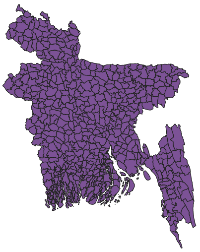
Now, we will work with a shapefile in QGIS and find out its projection system. First, we import a shapefile named BGD_adm4.shp from the folder Data under Chapter 2. To recall how to import a vector file, refer back to Chapter 1, Setting Up R and QGIS Environments for Geospatial Tasks.

Now, we will see the shapefile as follows:
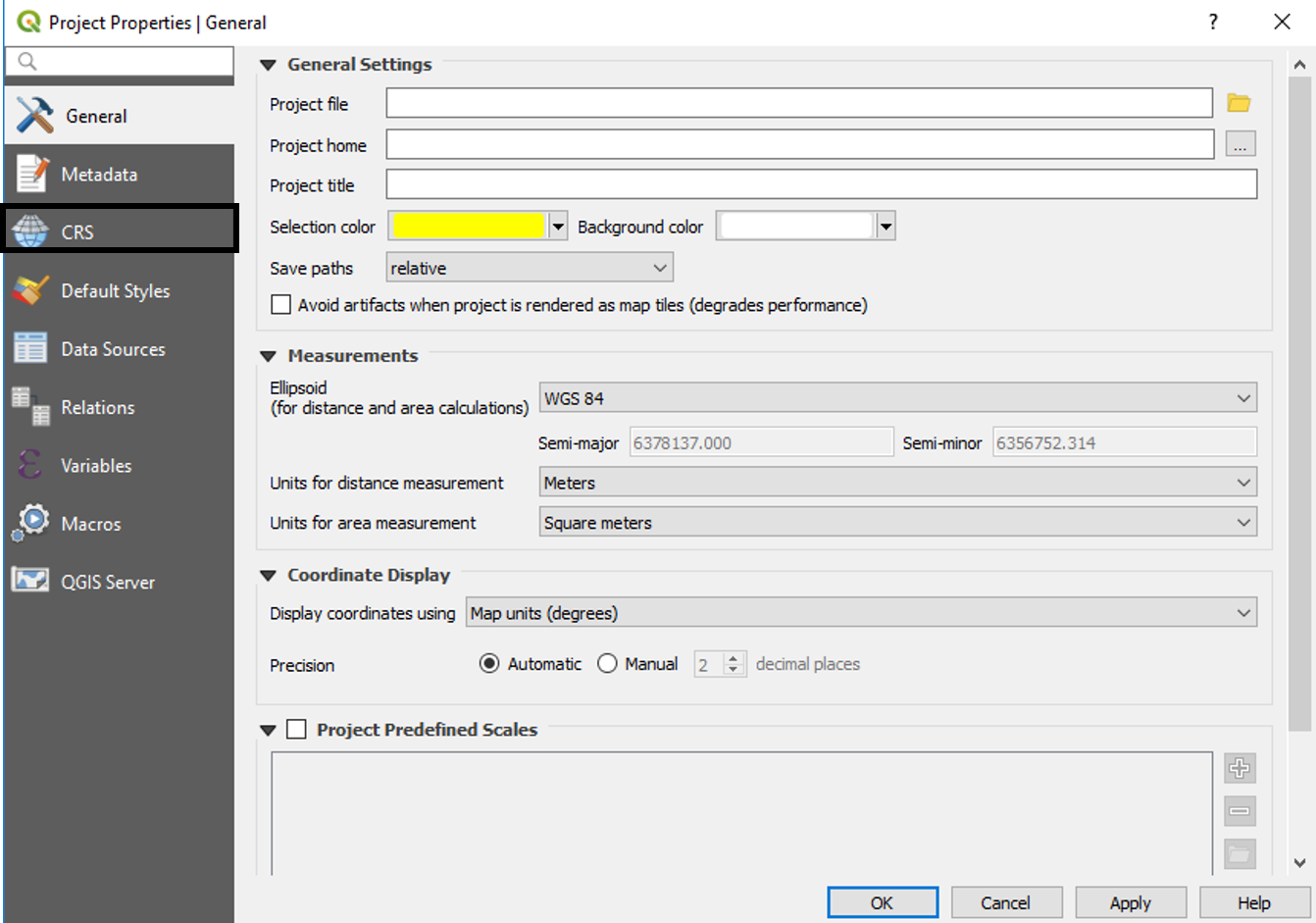
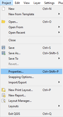
Now, to check out the projection system it is using, we need to click on Project Properties under Project in the menu bar as instructed in the following screenshot:

  1. Click on Project and then Properties... under it:
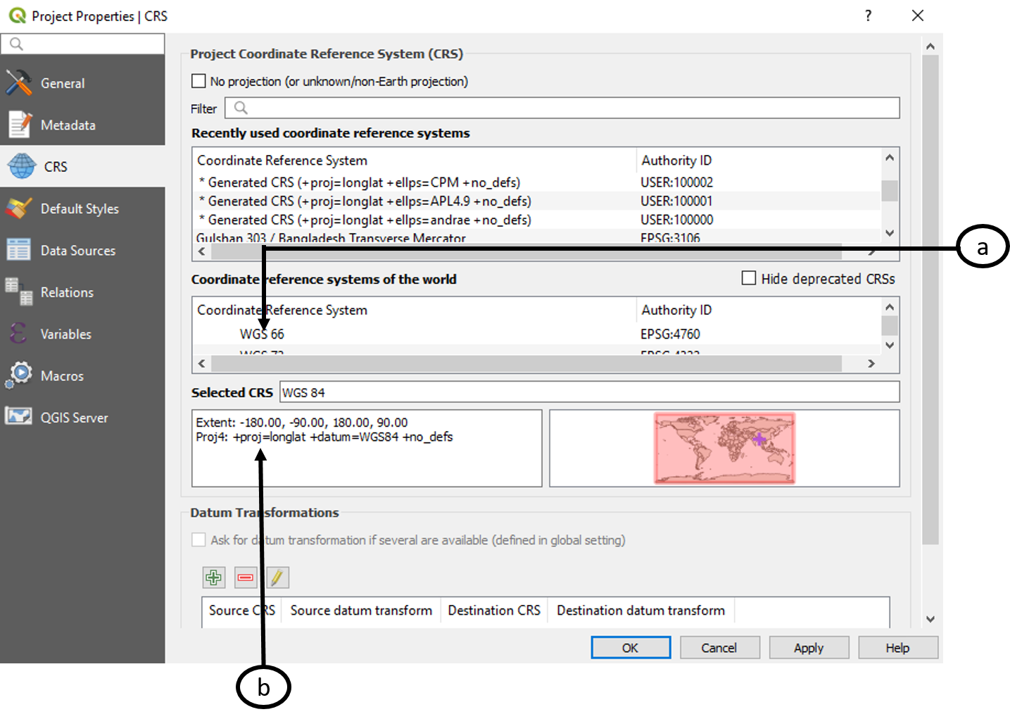
  1. Now, click on CRS:

Now, we can see the coordinate system (a) and the spatial extent and projection (b) as shown in this screenshot:
We can also select and change CRS from the Layer panel. We can do so using the following steps:

  1. Right-click on the BGD_adm4 layer in the Layer panel. Click on Properties as highlighted...
lock icon The rest of the chapter is locked
Register for a free Packt account to unlock a world of extra content!
A free Packt account unlocks extra newsletters, articles, discounted offers, and much more. Start advancing your knowledge today.
Unlock this book and the full library FREE for 7 days
Get unlimited access to 7000+ expert-authored eBooks and videos courses covering every tech area you can think of
Renews at $19.99/month. Cancel anytime
Banner background image